Home
Services
Onshore Survey Services
Underground Utility Survey
Offshore & Marine Survey Services
GIS (Geographical Information system)
Technology, Quality & Safety
Contact Us
Home
Services
Onshore Survey Services
Underground Utility Survey
Offshore & Marine Survey Services
GIS (Geographical Information system)
Technology, Quality & Safety
Contact Us
Get Consultation
Home
Services
Onshore Survey Services
Underground Utility Survey
Offshore & Marine Survey Services
GIS (Geographical Information system)
Technology, Quality & Safety
Contact Us
Home
Services
Onshore Survey Services
Underground Utility Survey
Offshore & Marine Survey Services
GIS (Geographical Information system)
Technology, Quality & Safety
Contact Us
Get Consultation
Onshore Survey
Services
Home
Onshore Survey Services
Services
Onshore Survey Services
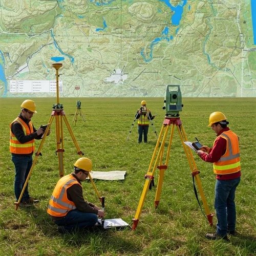
Land & Engineering Survey
As-built & dimensional control surveys
Control networks & benchmarks
Boundary & cadastral surveys
Route, corridor & ROW surveys
Topographic surveys
Aerial Survey / UAV (Drone Survey)
Volumetric & stockpile calculations
Construction progress monitoring
Aerial topographic surveys
Orthophoto mapping
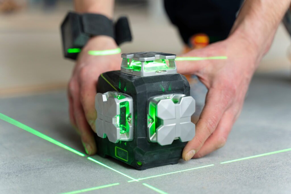
3D Laser Scanning
(LiDAR / Terrestrial Scanning)
High-density point cloud surveys
Industrial & structural scanning
Industrial & structural scanning
BIM & clash detection support
Deformation & Monitoring Survey
(Critical for mega projects)
Settlement monitoring
Structural movement monitoring
Prism, GNSS & sensor-based monitoring
Pre- and post-construction monitoring
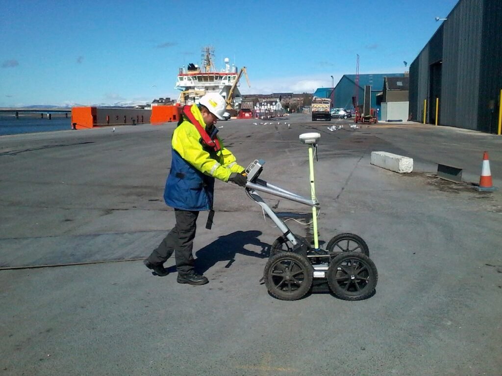
Geophysical & GPR Survey
Ground Penetrating Radar (GPR)
Subsurface anomaly detection
Void, cavity & foundation mapping
Pavement & road layer analysis
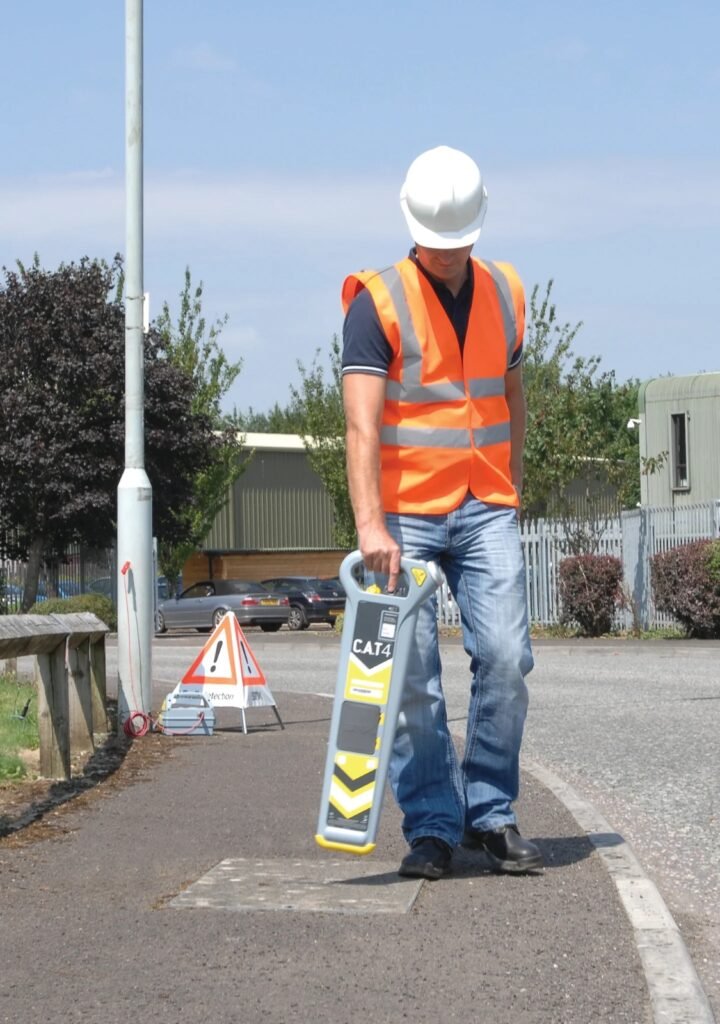
CAT4 Utility Survey (PAS 128 Compliant)
Integrated EM & GPR detection
Utility classification & confidence levels
Fully georeferenced utility drawings
Clash risk mitigation
Underground Utility Survey
Settlement monitoring
Structural movement monitoring
Prism, GNSS & sensor-based monitoring
Pre- and post-construction monitoring
Soil Investigation & Material Testing
Ground Penetrating Radar (GPR)
Subsurface anomaly detection
Void, cavity & foundation mapping
Pavement & road layer analysis
GIS Services
Integrated EM & GPR detection
Utility classification & confidence levels
Fully georeferenced utility drawings
Clash risk mitigation
Quick Links
Home
Technology, Quality & Safety
Contact
Onshore Survey Services
Land & Engineering Survey
Aerial Survey / UAV (Drone Survey)
3D Laser Scanning
Deformation & Monitoring Survey
Geophysical & GPR Survey
CAT4 Utility Survey
Soil Investigation & Material Testing
Offshore & Marine Survey Services
Hydrographic & Bathymetric Survey
Sonar Surveys
Marine Geophysical Survey
Dredging & Reclamation Survey
Offshore Positioning & Navigation Support
Coastal & Nearshore Survey
GIS Services
Mapping & Visualization
Spatial Data Collection & Management
Spatial Analysis & Modeling
Urban & Regional Planning
Infrastructure & Utility Mapping
Environmental & Natural Resources
Surveying & Engineering Integration
Disaster & Risk Management
Web GIS & Enterprise Solutions
Underground Utility Survey
CAT4 Cable Avoidance Tools (Power, Radio & Genny modes)
Ground Penetrating Radar (GPR) for non-metallic utilities
Electromagnetic pipe and cable locators
Passive and active signal detection
Manhole, chamber, and valve inspections
Vacuum excavation (trial pits) for confirmation if required
© 2026 Created with dunlinsurveys
Facebook-f
X-twitter
Instagram
Tumblr
Vimeo-v
Scroll to Top